

What Is Blue Carbon? Ecosystems, Stocks and Examples
Understand blue carbon in mangroves, seagrasses and salt marshes. Compare stocks, annual uptake and credits with examples from India and other coasts.
Blue carbon is carbon captured and stored by ocean and coastal ecosystems. In coastal conservation, the term commonly refers to mangroves, tidal salt marshes and seagrass meadows. Carbon occurs in their living plants and below ground in soils or sediments. A large existing carbon stock is different from new carbon taken up during a year.
NOAA’s blue carbon explainer connects this subject with protecting coastal habitats. The practical questions are where the carbon is, how it was measured, what could release it and what evidence supports a claimed change.
Mangroves, salt marshes and seagrass meadows
These habitats look different, so a blue carbon assessment needs to identify the ecosystem before selecting a measurement method. The Blue Carbon Initiative’s field manual addresses soil and vegetation pools, field planning, mapping and data management across all three.
| Ecosystem | What you see | What a photograph leaves out |
|---|---|---|
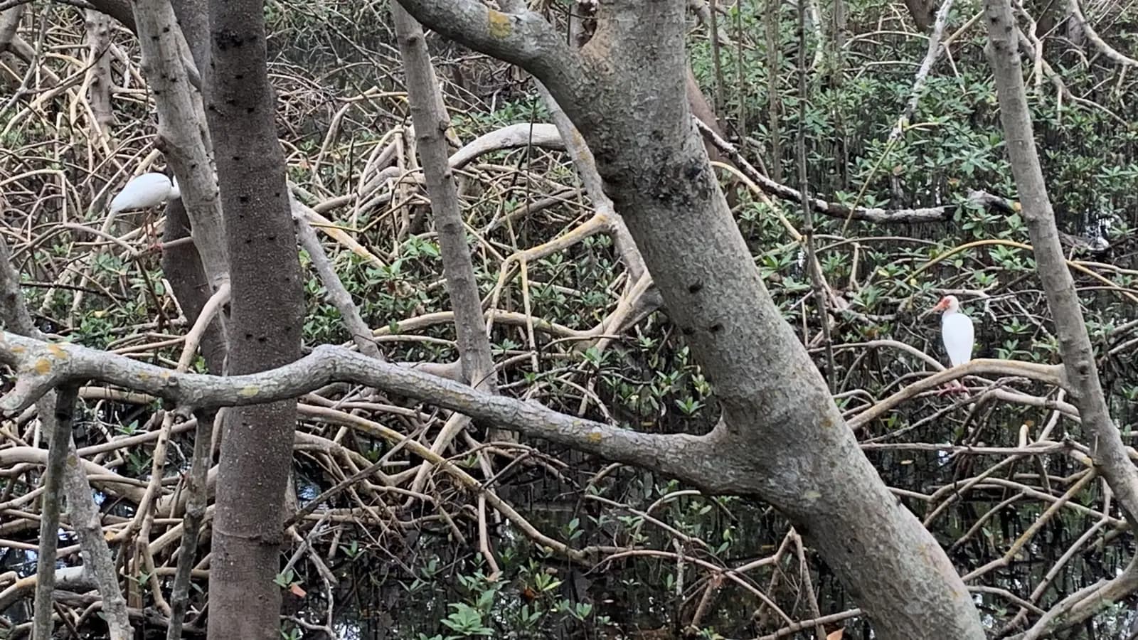
| Mangrove forest | Trees and shrubs in suitable tidal coastal settings. | Roots and soil carbon below the canopy. |
| Tidal salt marsh | Low coastal vegetation influenced by tidal water. | The carbon held beneath the visible vegetation. |
| Seagrass meadow | Submerged marine flowering plants. | Below-ground plant material and sediment carbon. |
The presence of vegetation does not establish a carbon quantity. Habitat boundaries, sampling depth and the pools included all affect what an inventory describes. Nor should a treeless coastal habitat be converted into mangroves simply to make it look more like a forest.
Where does coastal carbon go?
- Uptake: plants use carbon dioxide available from air or water as they grow.
- Living biomass: some carbon becomes leaves, stems, roots and other plant tissue.
- Soil and sediment: dead leaves, roots and other plant material contribute carbon below ground.
- Storage and losses: some carbon remains buried, while some returns through decomposition and respiration or is transported elsewhere.
NOAA explains that oxygen-poor wet soils can slow decomposition, allowing carbon to persist. The pathway is not a promise that every unit taken up stays indefinitely. Disturbance and erosion can change the balance.
Keep carbon stock separate from annual uptake
A stock is an amount held within a stated boundary and set of pools at a particular time. A rate describes an amount per unit of time. Read the units and the period before comparing two figures.
| Statement | What it describes | What it does not establish |
|---|---|---|
| 100 tonnes of carbon per hectare in the sampled soil layer | A stock density, with the sampling depth and method still needing to be stated. | An annual uptake rate or the amount stored in unsampled pools. |
| 10 ha × 100 t C/ha = 1,000 t C | An illustrative total for the same soil layer, assuming the estimate represents the whole area. | 1,000 tonnes of new removal or 1,000 carbon credits. |
| 2 tonnes of carbon per hectare per year | A hypothetical accumulation rate: 20 t C/year across 10 ha if that rate represents the whole area. | The site's total stock, its full greenhouse-gas balance or an issued credit quantity. |
| A later estimate is higher | A possible change to investigate using comparable methods and uncertainty estimates. | Proof that the project caused the difference. |
If the original samples covered only the top 30 centimetres, a later result covering one metre cannot be treated as growth in the same stock. Similarly, multiplying an area by a published average does not remove uncertainty about local conditions. The soil-carbon guide explains how depth, density and concentration affect a stock calculation.
How is blue carbon measured?
Start by stating the question. A baseline inventory asks how much carbon is present. A repeat inventory asks whether a comparable stock has changed. A study of burial rates asks how quickly carbon accumulates in sediments. Each needs an appropriate design.
The IAEA describes using sediment cores and dating techniques to estimate accumulation over time. Carbon measurements are combined with the sediment record rather than inferred from the appearance of the water surface. These techniques need specialist sampling and laboratory interpretation.
A commissioning brief should specify the mapped area, habitat classes, sampled pools and depths, field and laboratory methods, observation dates and uncertainty. The Blue Carbon Initiative manual provides the wider methodological framework. Remote sensing can help locate habitats and organise sampling; it does not directly measure all carbon buried beneath them.
Keep field identifiers attached to laboratory results and map locations. Ask whether the report includes only living biomass, only sediment, or both. When results are compared, confirm that the boundary and definitions have not changed silently.
Examples from India and other coasts
Tamil Nadu: several habitats within one coastal programme
The Tamil Nadu Green Climate Company’s Blue Carbon & GeoAI project page lists MSSRF and Microsoft India as partners and a 2025 start date. It describes work on mangroves, seagrass beds and tidal marshlands across areas including Pichavaram, Muthupet, the Gulf of Mannar and Palk Bay. This is an example of the programme’s stated scope, not evidence that every planned map or carbon estimate is complete.
Northeastern United States: an inventory of existing reservoirs
The US EPA’s March 2023 regional study combined habitat information and soil-carbon evidence for eelgrass meadows and salt marshes from Maine to Long Island. Its purpose was to establish a regional baseline of existing blue carbon reservoirs. That is a different question from how many additional removals a particular restoration project produced.
These examples show why blue carbon should not be reduced to mangrove planting. Local habitats determine the survey, and the survey objective determines which result can be claimed. For India’s mangrove geography and assessment-year figures, use the separate mangroves in India guide.
Does a blue carbon estimate create carbon credits?
No. An ecological inventory and a crediting claim answer different questions. A crediting programme requires an applicable methodology and evidence of the eligible greenhouse-gas benefit, with validation and verification under its rules. Existing stored carbon is not automatically an additional removal.
Verra’s VM0033 page, checked on 31 October 2026, lists version 2.1 as active and a major revision under development. It covers quantifying net greenhouse-gas reductions and removals from tidal-wetland restoration and identifies sea-level risk considerations. A project needs to check the rules that apply to its activity and timing, rather than relying on the label “blue carbon”.
Ask for the programme, methodology and version, project boundary, baseline, treatment of uncertainty and monitoring period. Where credits are claimed as issued, ask for the corresponding registry record. A map, a future estimate and a verified issued unit are different forms of evidence.
The carbon neutral versus net zero guide explains why an offset claim also needs clarity about reductions, removals and the scope of the claim.
Common questions about blue carbon
What is the difference between blue carbon and green carbon?
Blue carbon refers to ocean and coastal ecosystems. Green carbon is commonly used for carbon in terrestrial vegetation and soils, such as forests. The colours identify the setting; they do not make one carbon estimate more reliable than another.
What are the benefits of blue carbon ecosystems?
Alongside carbon storage, coastal habitats can support wildlife, fisheries, water quality and coastal protection. The IAEA’s coastal ecosystem overview explains these connections. Their scale depends on the habitat and local conditions, so a carbon estimate should not be used as a substitute for measuring the other benefits.
How much blue carbon does a hectare store?
There is no single reliable figure for every hectare. Specify the ecosystem, pools, sampling depth, location and method. A result for mangrove soil at one depth cannot be substituted for the total carbon in a seagrass meadow elsewhere.
Does every coastal restoration project need to sell credits?
No. Projects can be justified by habitat, fisheries or coastal-management objectives. If carbon finance is being considered, assess its evidence and long-term requirements separately. For the ecological planning sequence, continue with mangrove restoration methods and monitoring.
Sources checked on 31 October 2026. The 10-hectare calculation is illustrative and is not a carbon estimate, credit forecast or Mynzo project result.
See what mangrove restoration involves
Follow the decisions about site conditions, local priorities and repeat observations.
Read the mangrove restoration guide